
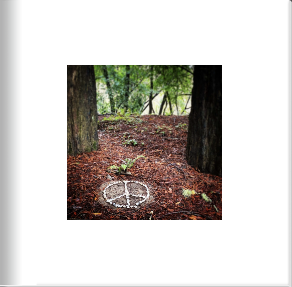
Jody Colley Photography
Vol. 2 (2019 - 2020)
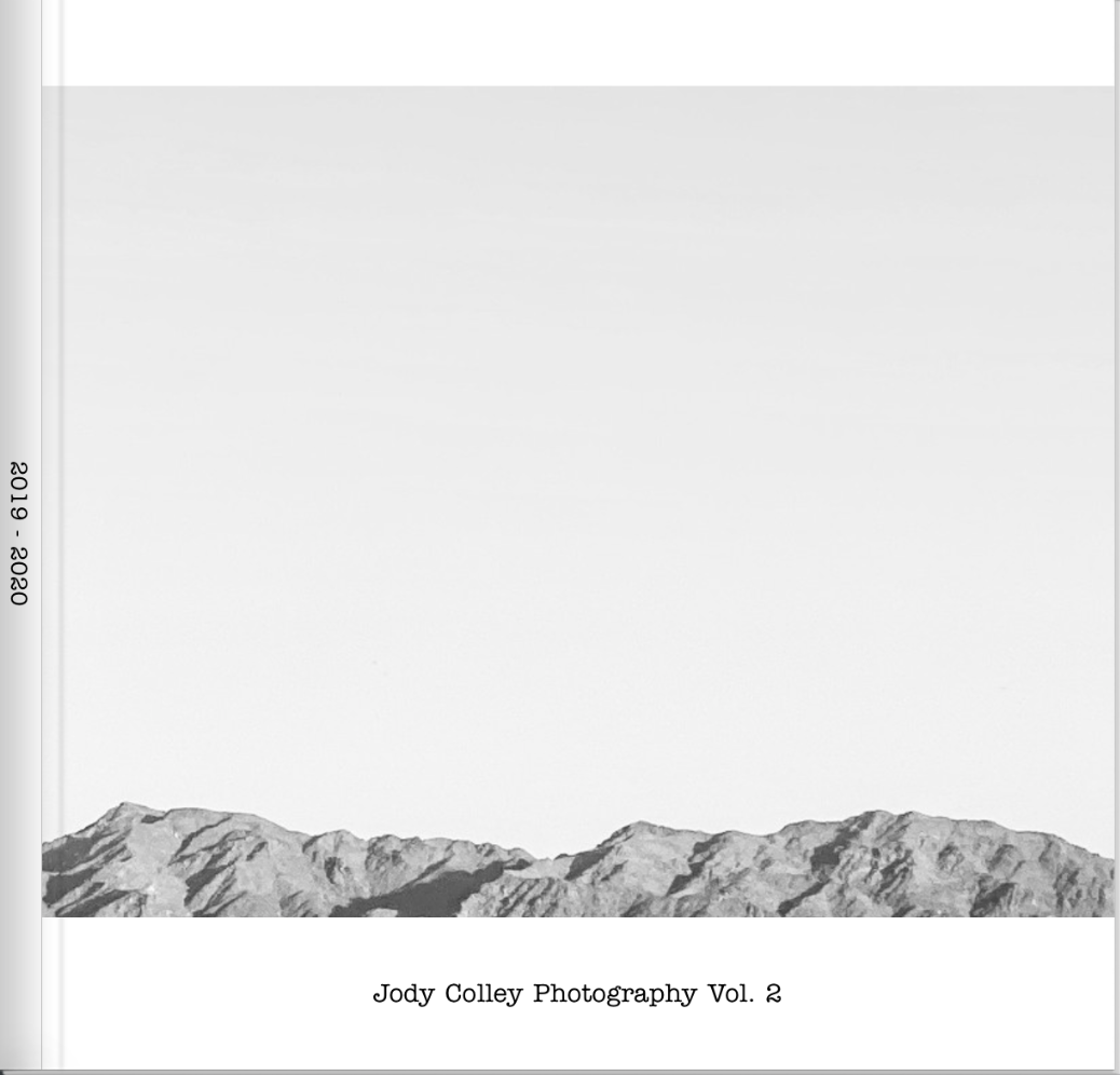
Vol. 2: Cover
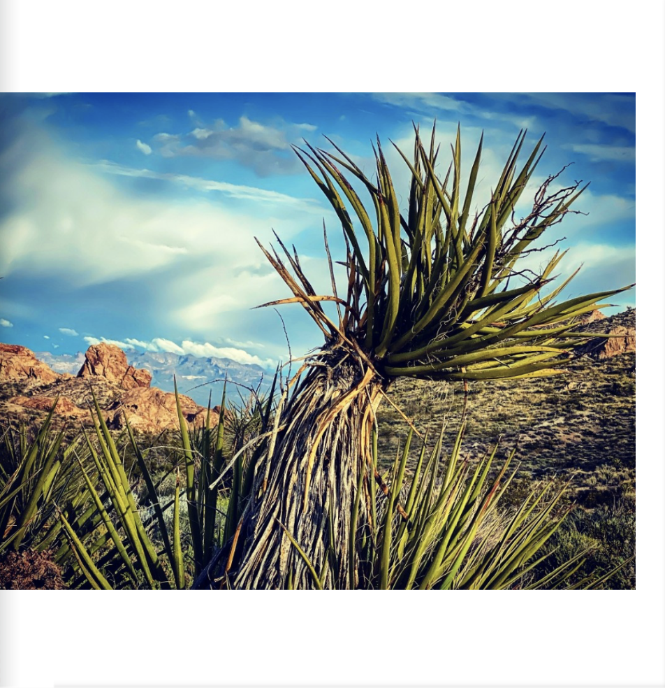
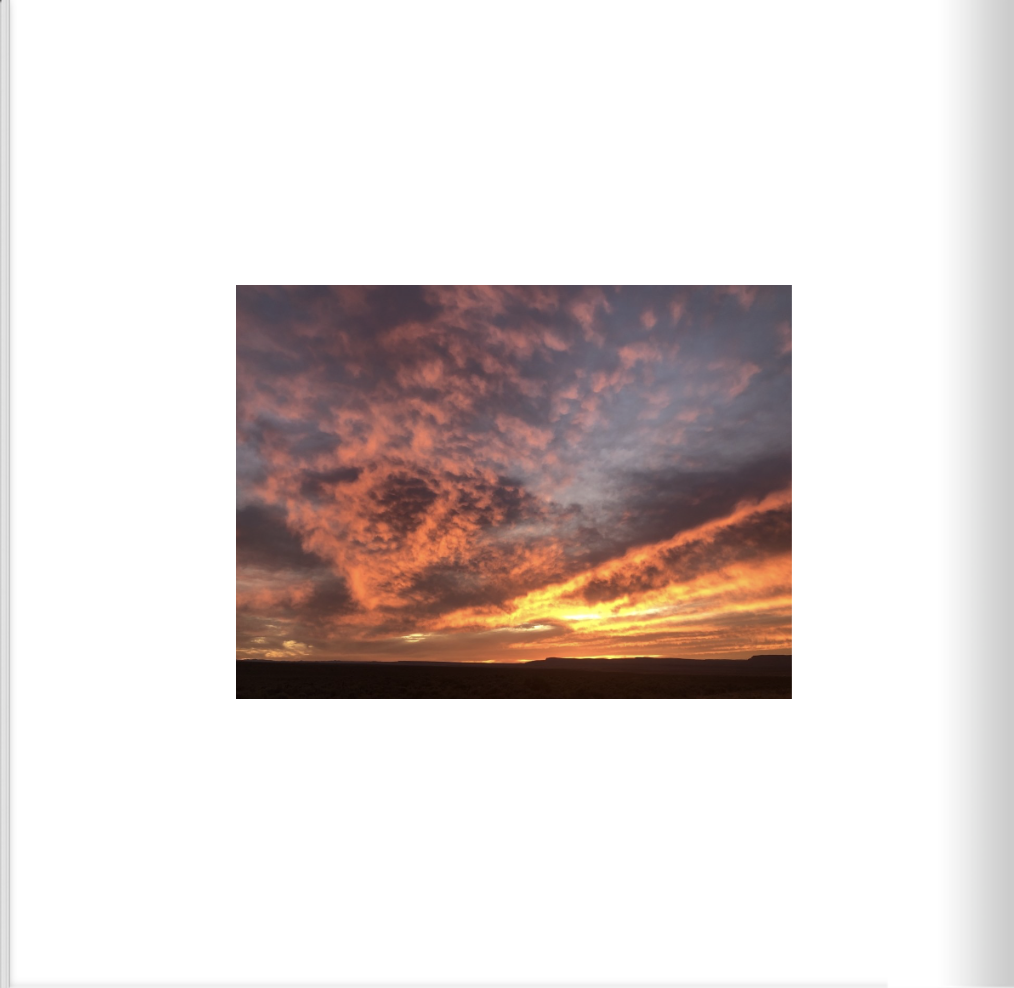
Ocotillo Wells, CA
More than 85,000 acres of magnificent desert are open for off-highway exploration and recreation within the boundaries portrayed on the park map are operated by California State Parks, OHMVR Division. Outside the boundaries, to the south and east, large tracts of BLM land (U.S. Department of the Interior, Bureau of Land Management) are also open to off-highway vehicles. The western boundary and part of the northern boundary connect with the 600,000-acre Anza-Borrego Desert State Park, which is closed to off-highway recreation, but open to exploration by highway-legal vehicles along established primitive roads.
Map to General Area

Vol. 2: Pg. 3
Trail Ridge, Rocky Mountain National Park, CO
Trail Ridge Road, Rocky Mountain National Park's heavily traveled highway to the sky, inspired awe before the first motorist ever traveled it. "It is hard to describe what a sensation this new road is going to make," predicted Horace Albright, director of the National Park Service, in 1931 during the road's construction. "You will have the whole sweep of the Rockies before you in all directions." But for all its harshness, the Trail Ridge tundra is a place of vibrant life and vivid colors. Pikas, marmots, ptarmigans and bighorn sheep are commonly seen. About 200 species of tiny alpine plants hug the ground. Despite a growing season that may last just 40 days, many bloom exuberantly, adorning the green summer tundra with swatches of yellow, red, pink, blue, purple and white. Forested moraines, great heaps of earth and rock debris left behind by melting Ice Age glaciers, rise above lush mountain meadows. The Continental Divide, where streamflows are separated east from west, is crossed at Milner Pass, located at a surprisingly low 10,758 feet elevation. Moose munch greenery in the upper reaches of the Colorado River, which flows through the scenic Kawuneeche Valley. Grazing elk greet sunrise and sunset in many of the forest-rimmed meadows found around the park. Trail Ridge Road is the highest continuous highway in the United States, climbing over the Continental Divide.
Map to General Area

Vol. 2: Pg. 4
Bear Canyon, NM
In this area, mining was mainly Zinc and the big business in the area was the Emerald Zinc mine built during World War I. Copper mining also took place here. The centerpiece of Bear Canyon Wildlife Area is Bear Canyon Reservoir, a 25-acre lake in Grant County. This small property provides fishing access and habitat for wildlife. The reservoir is located in a steep-sided rocky canyon on the Mimbres River. It sits at 6,000 feet in elevation and is surrounded by pinon, juniper, and oak vegetation. The nearest town of Mimbres has a population of 667.
Map to General Area

Vol. 2: Pg. 5
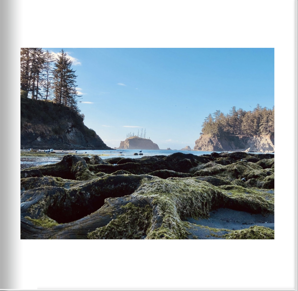
Hole in the Head, Bodega Bay, CA
Visitors of Bodega Bay know the famed Hole in the Head as a lush, tranquil pond — home to a variety of migrant birds — but it could have easily been a different story had it not been for the motley band of individuals that came together to derail plans for the PG&E nuclear reactor proposed for the site in the early 1960s. “The whole battle brought together a really improbable collection of people,” said Gaye LeBaron, famed columnist for Santa Rosa’s daily newspaper. LeBaron said the eclectic band of protestors included Rose Gaffney, a Polish immigrant widow of an Irish rancher; retired jazz trumpeter Lou Watters and his wife Pat; a San Francisco maritime museum director; a forestry student; a waitress at the Tides Wharf Restaurant in Bodega Bay; the leader of the most powerful conservation group in the West; and a young Sebastopol wife and mother, to name a few. The area boasts stunning coastlines and the Bodega Bay trailhead.
Map to General Area
Vol. 2: Pg. 6
Piute Valley, NV
The Piute Range is located in the Mojave Desert, primarily in northeast San Bernardino County, California, with a north portion in Nevada. Most of the range is the eastern border of the Mojave National Preserve, a National Park Service natural area and park. Fort Piute, one of a chain of military stations constructed to protect travellers on the Mojave Road from San Bernardino across the Mojave Desert to Fort Mojave on the Colorado River, lies at the southeastern end of the range near Piute Spring. The Piute Valley Watershed is the first major watershed southeast of Las Vegas to drain into the western side of the south-flowing Colorado River.
Map to General Area

Vol. 2: Pg. 7
Blackrock, CA
This area of rural Inyo County hosts a rest area off highway 395 and spectacular views of the Eastern Sierra Nevadas in California.
Map to General Area

Vol. 2: Pg. 8
Lake Berryessa, CA
One of the largest bodies of fresh water in California, Lake Berryessa offers boating, water skiing, wake-boarding, tubing and other fast-paced water sports, plus quiet coves for kayaking, swimming and fishing. In the summer, the water can reach 75 degrees — the perfect cool-down after a hike or a stroll through sun-drenched vineyards. This reservoir in the Vaca Mountains was formed following the construction of the Monticello Dam on Putah Creek in the 1950s. Since the early 1960s, this reservoir has provided water and hydroelectricity to the North Bay region of the San Francisco Bay Area.

Vol. 2: Pg. 9
Organ Pipe Cactus National Monument, AZ
Organ Pipe Cactus National Monument preserves over 330,000 acres of green, living desert that is yours to explore and get to know. Because of its amazing biodiversity, this place is considered a mecca for Sonoran Desert Research and is honored with a designation by UNESCO as an International Biosphere Reserve. Each of the plants have learned tricks and techniques to survive heat and drought, as well as freezing temperatures and floods. This is a land of extremes when it comes to plant life.
Map to General Area

Vol. 2: Pg. 10
Columbus, NM
Columbus was established in 1891 just across the Mexican border from Palomas, Chihuahua, and named after 15th-century explorer Christopher Columbus. On March 9, 1916, on the orders of Mexican revolutionary leader Pancho Villa, Colonel Francisco Beltrán, Colonel Candelario Cervantes, General Nicolás Fernández, General Pablo López, and others led 500 men in an attack against the town, which was garrisoned by a detachment of the 13th Cavalry Regiment. Villa's army burned a part of the town and killed seven or eight soldiers and 10 residents before retreating back into Mexico. United States President Woodrow Wilson responded to the Columbus raid by sending 10,000 troops under Brigadier General John J. Pershing to Mexico to pursue Villa. This was known as the Punitive Mexican Expedition or Pancho Villa Expedition. The expedition was eventually called off after failing to find Villa, who had escaped. The Pershing expedition brought prosperity and international attention to Columbus and a realization that war had come to the border of the United States.
Map to General Area

Vol. 2: Pg. 11
Saint Catherine's Chapel on the Rock, CO
In the early twentieth century, a man by the name of William McPhee owned the land that is now Camp St. Malo. McPhee was a parishioner of the Cathedral parish in Denver, and he often allowed the parish to take kids hiking and camping on his property. During one of those trips, several campers saw a meteorite or shooting star that had appeared to hit the earth. They went looking for it and came upon the Rock that now stands as the foundation of St. Catherine of Siena Chapel. The Rock immediately evoked a reminder of Our Lord’s words to Peter “On this rock I will build my Church.” The chapel would not be built until 1935, and only after struggles with the Colorado Highway Department who wanted to use the rock for road base. St. Catherine of Siena Chapel, also referred to as the Chapel on the Rock, is what stands visible to this day.
Map to General Area
Vol. 2: Pg. 12
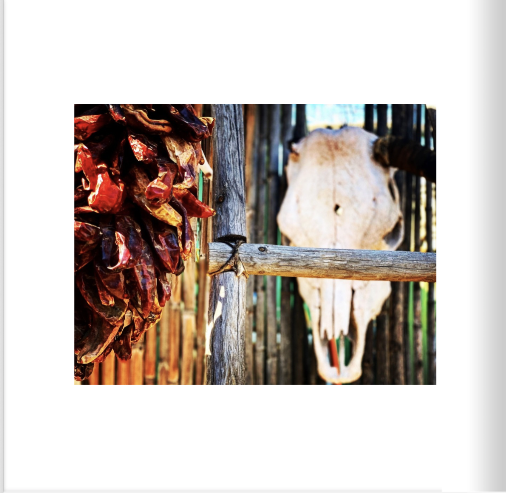
Las Cruces, NM
Las Cruces is a city in New Mexico, on the edge of the Chihuahuan Desert. The interactive New Mexico Farm and Ranch Heritage Museum features livestock and gardens. On the Rio Grande, Mesilla Valley Bosque State Park has trails and birdlife. The Museum of Nature and Science includes desert animals and hands-on displays. In an old depot, the Railroad Museum has model trains and explores the local impact of railways. Las Cruces is the economic and geographic center of the Mesilla Valley, the agricultural region on the floodplain of the Rio Grande which extends from Hatch to the west side of El Paso, Texas. The Organ Mountains, 10 miles to the east, are dominant in the city's landscape, along with the Doña Ana Mountains, Robledo Mountains, and Picacho Peak.
Jody’s note: Las Cruces was a pleasant surprise as I got to know the town beyond what first impression it gives. Also, they have the best food of anywhere I ever been, especially at the farm to fork restaurants. They have mastered the use of spices — not too hot or overwhelming, just purely delicious flavors.

Vol. 2: Pg. 13
Organ Pipe Cactus National Monument, AZ
Organ Pipe Cactus National Monument preserves over 330,000 acres of green, living desert that is yours to explore and get to know. Because of its amazing biodiversity, this place is considered a mecca for Sonoran Desert Research and is honored with a designation by UNESCO as an International Biosphere Reserve. Each of the plants have learned tricks and techniques to survive heat and drought, as well as freezing temperatures and floods. This is a land of extremes when it comes to plant life.
Jody’s note: I have a genuine affection for most places I travel, but if pressed, I will say Organ Pipe Cactus National Monument (in the winter) is my favorite. You will see a lot of photos from this area in my albums.
Map to General Area

Vol. 2: Pg. 14
Marfa, TX
Marfa, a small desert city in west Texas, is known as an arts hub. The Chinati Foundation, founded by artist Donald Judd, displays huge indoor and outdoor installations on an old army base. The Ballroom Marfa arts center hosts exhibitions, concerts and the Marfa Myths cultural festival. Outside town is a viewing platform from which the mysterious orbs known as the “Marfa Lights” phenomenon can sometimes be seen. Today, there's still plenty of Giant memorabilia still on display celebrating the impact of what is perhaps the most iconic film ever shot in Texas on the area.
Map to General Area

Vol. 2: Pg. 15
Marfa, TX
Marfa, a small desert city in west Texas, is known as an arts hub. The Chinati Foundation, founded by artist Donald Judd, displays huge indoor and outdoor installations on an old army base. The Ballroom Marfa arts center hosts exhibitions, concerts and the Marfa Myths cultural festival. Outside town is a viewing platform from which the mysterious orbs known as the “Marfa Lights” phenomenon can sometimes be seen. Today, there's still plenty of Giant memorabilia still on display celebrating the impact of what is perhaps the most iconic film ever shot in Texas on the area.
Map to General Area

Vol. 2: Pg. 16
Estes Park, CA
A popular summer resort and the location of the headquarters for Rocky Mountain National Park, Estes Park lies along the Big Thompson River. Estes Park has a population of 5,858. Landmarks include The Stanley Hotel which inspired the book, The Shining. The town overlooks Lake Estes and Olympus Dam. Before Europeans came to the Estes Park valley, the Arapaho Indians lived there in the summertime and called the valley "the Circle." Many early visitors came to Estes Park in search of better health. The Rocky Mountain West especially attracted those with pulmonary diseases, and in Estes Park some resorts catered to them, providing staff physicians for their care. Estes Park sits at an elevation of 7,522 feet.
Jody’s note: I was in Estes Park during a period of large wildfires nearby. The smoke in the sky created daytime “sunsets” that were pretty spectacular, and eerie, to see.
Vol. 2: Pg. 17
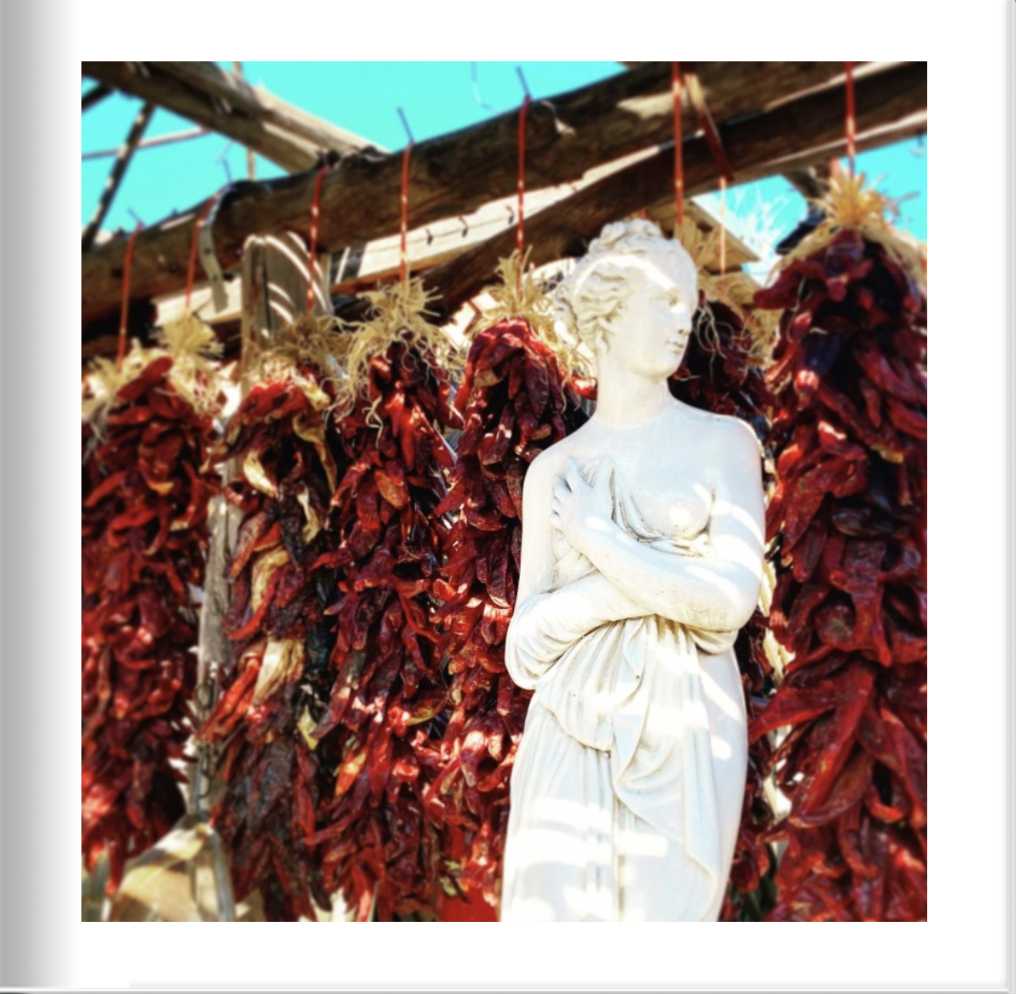
Old Mesilla, NM
The heart of the picturesque village of Mesilla is much the same as it was one hundred years ago. Thick walled adobe buildings, which once protected residents against Apache attacks, now house art galleries, restaurants, museums and gift shops. Today, tourists stroll on the peaceful plaza and imagine life as it might have been many years ago. Mesilla's most notorious resident, Billy the Kid, was sentenced to death at the county courthouse, but escaped before the sentence was carried out. Legendary hero Pat Garrett eventually tracked down and killed the Kid; later, Garrett was mysteriously murdered in an arroyo just outside of Las Cruces. He is buried in a local cemetery.
Jody’s note: This town is worth a visit to shop, eat, and take in the history. Perhaps a little touristy, it still offers loads of charm and that other-world feeling that makes it so unique. There are high-end offerings as well as eclectic shops offering spices, statures, bicycles, gourds, and random trinkets—all under one roof.
Map to General Area

Vol. 2: Pg. 18
Winters, CA
Winters is a small city located on Putah Creek in the western Sacramento Valley, near the northeastern Vaca Mountains foothills. William Wolfskill, a Kentucky immigrant to Mexican Alta California, received a Mexican land grant for Rancho Rio de los Putos in 1842 from Governor Juan Bautista Alvarado. His brother, John Reid Wolfskill, started the agricultural development of the Sacramento Valley by planting orchards and vineyards on his lands. In 1849, William Wolfskill transferred half of Rancho Rio de los Putos to John Wolfskill, and transferred the rest to his brother in 1854. The Winters post office was established in 1875. Winters incorporated in 1898. The name honors Theodore Winters, whose ranch provided half of the town's land. In 1935, Wolfskill's heirs deeded 100 acres of the Wolfskill Ranch in Winters to the University of California, Davis, which had been founded in 1908. The land was to be used for an experimental orchard.
Map to General Area

Vol. 2: Pg. 19
Monticello Dam, CA
Monticello Dam is a 304-foot high concrete arch dam in Napa County, California, constructed between 1953 and 1957. The dam impounded Putah Creek to create Lake Berryessa in the Vaca Mountains. The reservoir took five years to fill after construction, reaching capacity for the first time on April 18, 1963. Lake Berryessa is currently the seventh-largest man-made lake in California. Water from the reservoir primarily supplies agriculture in the Sacramento Valley downstream. The dam is noted for its classic, uncontrolled morning-glory-type spillway. Locally, the spillway is also known as the "Glory Hole". To the south is Putah Creek State Wildlife Area.
Map to General Area

Vol. 2: Pg. 20
San Onofre Nuclear Power Plant, San Onofre, CA
The San Onofre Nuclear Generating Station (SONGS) is a permanently closed nuclear power plant located south of San Clemente, California, on the Pacific coast, in Nuclear Regulatory Commission Region IV. The plant was shut down in 2013 after replacement steam generators failed; it is currently in the process of decommissioning. Controversy continues over Edison's plans for on-site dry cask storage of the considerable amount of nuclear waste created during the facility's decades of operation.
Map to General Area
Vol. 2: Pg. 21
Monte Rio, CA
Along the banks of Sonoma County's Russian River, the hamlet of Monte Rio (pop. 1,152) knows how to roll out the welcome mat with flair. Tourists flocked by train starting in the 1870s, then came by the thousands in the 1930s and ’40s to hear Big Bands play in the town's outdoor pavilions. Today, a historic 1950s-style neon sign arches overhead, proclaiming "Welcome to Monte Rio Vacation Wonderland." Located on the north end of the 10-mile scenic stretch known as the Bohemian Highway, this little burg spreads out on both sides of the river. That slogan still rings true for those who want to enjoy splashing or paddling on the river, taking in fabulous views, visiting nearby world-class wineries, enjoying local theater, biking along winding roads lined with redwoods, fishing, hiking, or having picnics on a sandy river beach. It's home to the Monte Rio Amphitheater, an outdoor showcase for concerts, theater under the stars, and other events.
Map to General Area

Vol. 2: Pg. 22
Glacier National Park, MT
Glacier Park's varied climate influences and its location at the headwaters of the Pacific, Atlantic and Hudson Bay drainages have given rise to an incredible variety of plants and animals. Both Glacier National Park and Waterton Lakes National Park, across the border in Canada, were designated International Biosphere Reserves and together were recognized in 1995 as a World Heritage Site. Glacier National Park is a 1,583-sq.-mile wilderness area in Montana's Rocky Mountains, with glacier-carved peaks and valleys running to the Canadian border. It's crossed by the mountainous Going-to-the-Sun Road which was used in the opening scene of the film, The Shining.
Map to General Area

Vol. 2: Pg. 23
Mono Hot Springs, CA
Located between Yosemite and Kings Canyon on the west slope of the Sierra’s you’ll find over a dozen natural mineral hot springs running along the south bank of the south fork of the San Joaquin River with cabins at the resort, a restaurant and camping. You can reach these rustic hot springs in the Mono Basin – not to be confused with Mono Lake on the east slope of the Sierra – by traveling over 9,100 ft. Kaiser Pass Road with spectacular views of the “Range of Light” that is some of the most beautiful light colored granite in the Sierras Nevada. There you can hike to the balancing rock with views of Florence Lake below.
Map to General Area

Vol. 2: Pg. 24
Organ Pipe Cactus National Monument, AZ
Organ Pipe Cactus National Monument preserves over 330,000 acres of green, living desert that is yours to explore and get to know. Because of its amazing biodiversity, this place is considered a mecca for Sonoran Desert Research and is honored with a designation by UNESCO as an International Biosphere Reserve. Each of the plants have learned tricks and techniques to survive heat and drought, as well as freezing temperatures and floods. This is a land of extremes when it comes to plant life.
Map to General Area

Vol. 2: Pg. 25
Sonoma Coast State Park, CA
The property lies along State Route 1 and consists of a number of named beaches including Arched Rock Beach, Gleason Beach and Goat Rock Beach. The ecosystem consists of alternating sandy beaches and rocky shoreline, with a marine terrace extending above the entire extent with an upland California coastal prairie habitat.

Vol. 2: Pg. 26
Lava Beds National Monument, CA
Lava Beds National Monument is a land of turmoil, both geological and historical. Over the last half-million years, volcanic eruptions on the Medicine Lake shield volcano have created a rugged landscape dotted with diverse volcanic features. More than 800 caves, Native American rock art sites, historic battlefields and campsites, and a high desert wilderness experience await visitors to this remote part of California. During the Modoc War of 1872-1873, a small band of Modocs used their knowledge of the homeland's terrain to their tactical advantage. This area is still infused with cultural and spiritual importance for many modern people of Modoc and Klamath descent.
Map to General Area

Vol. 2: Pg. 27
Tahoe City, Lake Tahoe, CA
Tahoe City is located on the shore of Lake Tahoe, at the outlet of the Truckee River. Tahoe City activities revolve around snow and everything one can do in, on or around it. Enjoy four-star dining, homegrown coffee shops, shopping, galleries, and a leisurely stroll through town on the Lake-view boardwalk any time. Once a destination for travelers to and from the Comstock Lode (c.1870’s) that featured a narrow-gauge railway stop and the steamer S.S. Tahoe, Tahoe City’s century-old heritage, historic sites (some claim haunted) and museums provide much history to explore as well.
Map to General Area

Vol. 2: Pg. 28
Winnemucca, NV
Winnemucca has greeted travelers at the "Crossroad of the West" for over 100 years. The community is happy to provide responsible, friendly service to everyone whether you are stopping for a quick bite to eat or planning to stay for longer. This little town is right in the heart of Cowboy Territory and was named in honor of Paiute Chief Winnemucca of the local Northern Paiute tribe, a tribe who traditionally lived in the area. Loosely translated to mean ‘one moccasin,’ Chief Winnemucca and his daughter Sarah Winnemucca Hopkins learned how to speak English and were advocates for the fair treatment of Paiute and Shoshone people in the area. Sara became the first American Indian woman to publish a book in the English language. Today, many of Winnemucca’s locals find employment with area mines and other cultural establishments.
Map to General Area

Vol. 2: Pg. 29
Organ Pipe Cactus National Monument, AZ
Organ Pipe Cactus National Monument preserves over 330,000 acres of green, living desert that is yours to explore and get to know. Because of its amazing biodiversity, this place is considered a mecca for Sonoran Desert Research and is honored with a designation by UNESCO as an International Biosphere Reserve. Each of the plants have learned tricks and techniques to survive heat and drought, as well as freezing temperatures and floods. This is a land of extremes when it comes to plant life.
Map to General Area

Vol. 2: Pg. 30
Occidental, CA
As the midpoint on the exceptionally scenic 10-mile drive known as the Bohemian Highway, Occidental attracts cyclists and car clubs as the starting point for a number of beautiful and challenging routes between the redwoods and the coast. A favorite is to head west on picturesque Coleman Valley Road, which climbs over the ridge and then descends to Highway 1 along the coast. Founded in 1876, Occidental was a stop on the North Pacific Coast Railroad connecting Cazadero to the Sausalito ferry. In return for donating right-of-way to the railroad, a local landowner named "Dutch Bill" Howards received a lifetime railway pass, and the station was named after him. The railway caused a rapid expansion of the timber industry, and by 1877 there were six sawmills in the Occidental area. Trains also brought vacationers from San Francisco.
Jody’s note: The backroads of Sonoma County are totally work exploring. They connect Sonoma’s cute little towns and are full of beautiful ranches and historic treasures like old schoolhouses and churches from the turn of the century.
Map to General Area
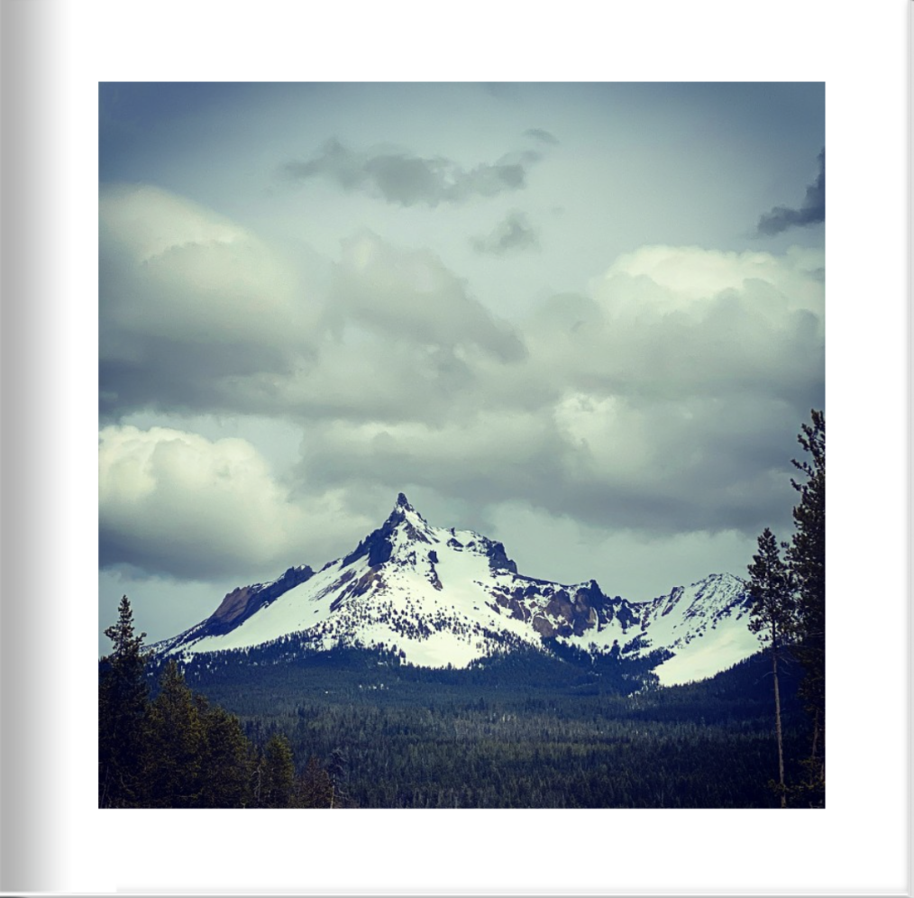
Vol. 2: Pg. 31
Mt. Thielson, OR
Mt. Thielson is an extinct shield volcano in the Oregon High Cascades. Because eruptive activity ceased 250,000 years ago, glaciers have heavily eroded the volcano's structure, creating precipitous slopes and a horn-like peak. The spire-like shape of Thielsen attracts lightning strikes and creates fulgurite, an unusual mineral. The prominent horn forms a centerpiece for the Mount Thielsen Wilderness, a reserve for recreational activities such as skiing and hiking. The area surrounding the volcano was originally inhabited by Klamath Native Americans, and was later encountered by settlers. One of the visitors was Jon Hurlburt, an early explorer of the area who named the volcano after the engineer Hans Thielsen. Later explorers discovered nearby Crater Lake.
Map to General Area

Vol. 2: Pg. 32
Organ Pipe Cactus National Monument, AZ
Organ Pipe Cactus National Monument preserves over 330,000 acres of green, living desert that is yours to explore and get to know. Because of its amazing biodiversity, this place is considered a mecca for Sonoran Desert Research and is honored with a designation by UNESCO as an International Biosphere Reserve. Each of the plants have learned tricks and techniques to survive heat and drought, as well as freezing temperatures and floods. This is a land of extremes when it comes to plant life.
Map to General Area
Vol. 2: Pg. 33
Christmas Tree Pass, NV
Christmas Tree Pass is a pass that leads over the Newberry Mountains in southern Nevada. The road that crosses the pass is called, appropriately enough, Christmas Tree Pass Road. The road begins just outside the town of Laughlin off of NV Highway 163, and ends to the south of the tiny town of Searchlight, NV, on highway 93. This scenic drive is twelve miles in length. The road itself is gravel and is generally in good condition. However, in a few places the road can be a bit rough and steep, particularly right below the pass on the eastern side. Although some careful and slow driving will allow a passenger car to traverse the occasional deep ruts and holes that form here—a high clearance vehicle can be quite helpful. The trip over Christmas Tree Pass is very enjoyable. You get some fine views of the Colorado River valley down below, where Laughlin is located. And you get sweeping views into Arizona. And once you reach the western side of the pass…the sprawling Mojave Desert just goes on and on.
Jody’s note: I’ve been to this area many times, but only recently adventured up Christmas Tree Pass. I can’t believe I hadn’t as it’s a real gem. You need 4-wheel drive to go the full distance, but it’s worth a long day trip!
Map to General Area

Vol. 2: Pg. 34
Dumont Lake, CO
The 50-acre Dumont Lake is surrounded by a spruce-fir forest and alpine meadow that boasts colorful wildflowers in warmer months. It sits near the base of Rabbit Ears Peak in the Routt National Forest. The Medicine Bow-Routt National Forests and Thunder Basin National Grassland encompass nearly three million acres from central and northeastern Wyoming to north-central Colorado. Black bear, bobcat, coyote, elk, mule deer and moose are just some of the many animals that inhabit these rich and diverse lands. Dumont Lake is particularly known for its birding opportunities. The area offers spin and fly fishing for trout in the lake and stream, as well as access to hiking, backpacking and mountain biking on the many nearby dirt roads and trails. Campers can reach the two-mile Rabbit Ears Trail from the facility, and the Continental Divide National Scenic Trail nearby. Rock climbers can also find routes in the area.
Jody’s note: Not pictured here are the massive amounts of colorful wildflowers growing in this area, more than I’ve seen in any other alpine region.
Map to General Area
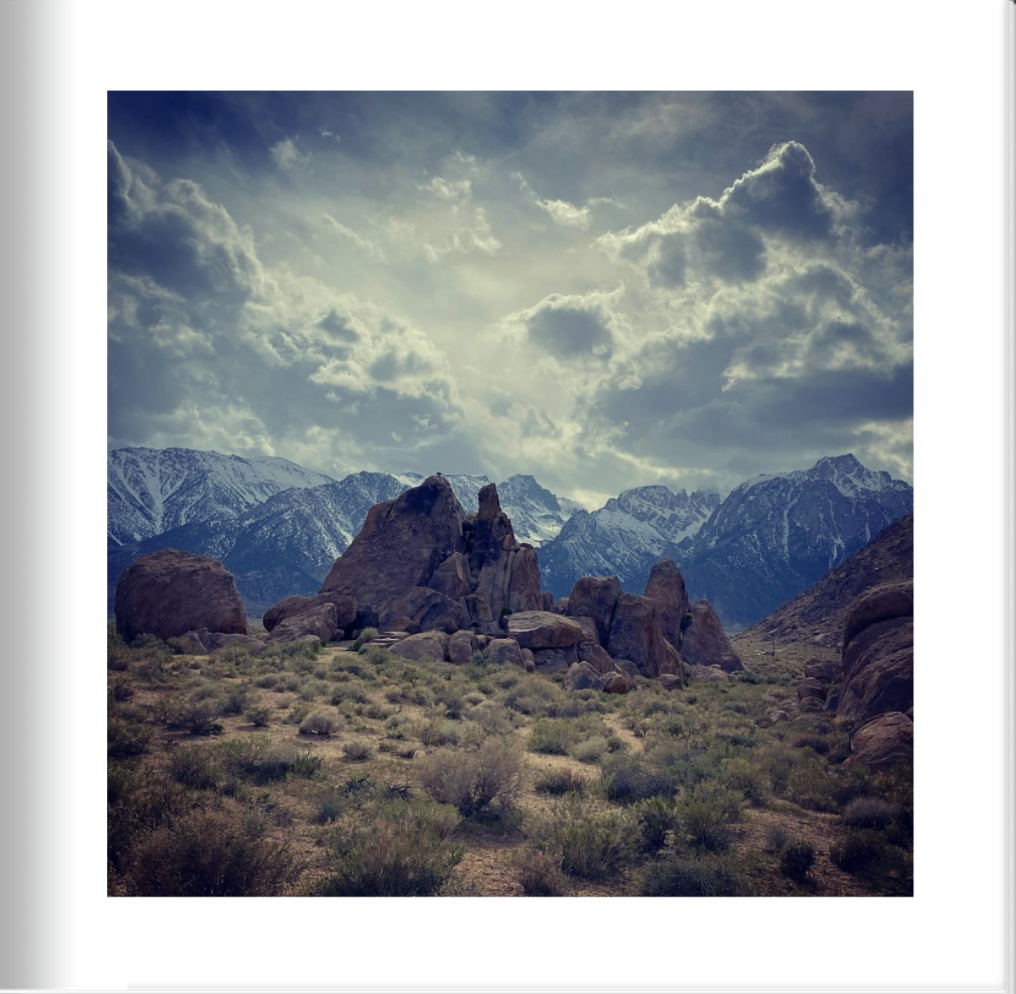
Vol. 2: Pg. 35
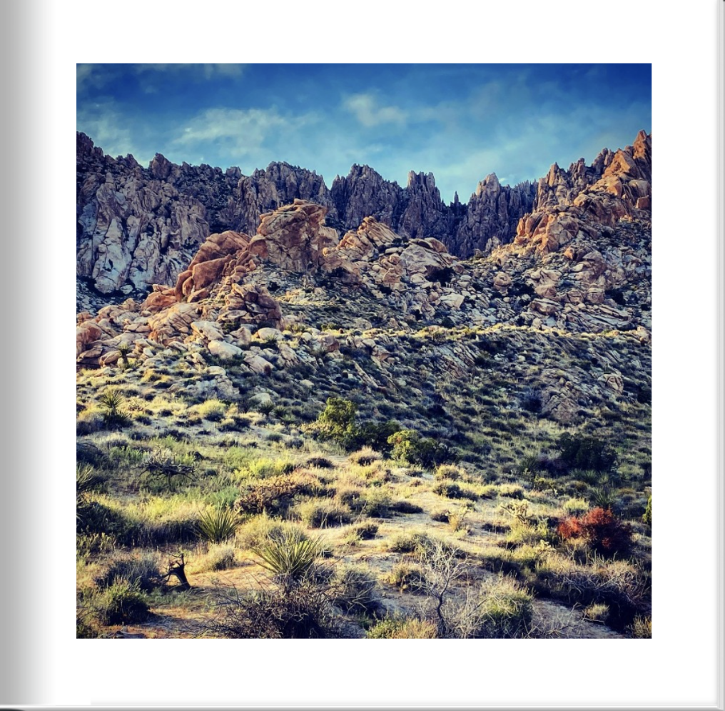
Alabama Hills, CA
The Alabama Hills are a formation of rounded rocks and eroded hills set between the jagged peaks of the Sierra Nevada and the geologically complex Inyo Mountains. Both geologic features were shaped by the same uplifting occurring 100 million years ago. Though geographically separate from the Sierra Nevada, they are part of the same geological formation. The Alabama Hills location as a gateway to Mt. Whitney, the tallest mountain in the contiguous United States, and the Eastern Sierra Nevada Mountains. The Alabama Hills were named for the CSS Alabama, a Confederate warship deployed during the American Civil War. When news of the ship's exploits reached prospectors in California sympathetic to the Confederates, they named many mining claims after the ship, and the name came to be applied to the entire range. The Alabama Hills are a popular filming location for television and movie productions, especially Westerns set in an archetypical "rugged" environment. Since the early 1920s, 150 movies and about a dozen television shows have been filmed here.
Jody’s note: One of my favorite places in the United States, along with the entire Highway 395 drive along the Eastern Sierras. This area is especially known for the free camping opportunities and access to Mt. Whitney, the tallest mountain in the US outside of Alaska.
Map to General Area

Vol. 2: Pg. 36
Bonneville Salt Flats, UT
The Salt Flats were formed when ancient lake Lake Bonneville dried up. The lake was huge, filling much of the Great Basin. It eventually shrank below its outlet and so its water became salty. As water continued to evaporate, salt deposits were left in many areas. The Great Salt Lake is a remnant of Lake Bonneville. Several roads probe the Salt Flats from many directions. They often extend into very remote locations where conditions are harsh and there are no services. The flats include a variety of micro environments. In some spots the soil is so salty it prevents vegetation growth. These spots seem to be totally desolate. In other places you will find numerous kinds of plants and animals. Ponds and marshy areas can be found in spots near the edges of the flats and they provide critical habitat for plants and animals. The federal government owns almost all of the land in this area and large portions are used by the military for storage depots, test areas and bombing ranges. These sections are fenced and marked, and public access is prohibited.
Map to General Area

Vol. 2: Pg. 37
Yosemite National Park, CA
Yosemite is one of the largest and least fragmented habitat blocks in the Sierra Nevada, and the park supports a diversity of plants and animals. The park has an elevation range from 2,127 to 13,114 feet and contains five major vegetation zones: chaparral and oak woodland, lower montane forest, upper montane forest, subalpine zone, and alpine. Of California's 7,000 plant species, about 50% occur in the Sierra Nevada and more than 20% are within Yosemite. The park contains suitable habitat for more than 160 rare plants, with rare local geologic formations and unique soils characterizing the restricted ranges many of these plants occupy. About 10 million years ago, the Sierra Nevada was uplifted and then tilted to form its relatively gentle western slopes and the more dramatic eastern slopes. The uplift increased the steepness of stream and river beds, resulting in the formation of deep, narrow canyons. About one million years ago, snow and ice accumulated, forming glaciers at the higher alpine meadows that moved down the river valleys. Ice thickness in Yosemite Valley may have reached 4,000 feet during the early glacial episode. The downslope movement of the ice masses cut and sculpted the U-shaped valley that attracts so many visitors to its scenic vistas today.
Map to General Area
Vol. 2: Pg. 38
Dixon, CA
The first settlement in the Dixon area was in 1852 during the California gold rush. By 1865, the community boasted a general store, post office, blacksmith, and had a population of 150 people.
Map to General Area
Vol. 2: Pg. 39
Sunset Bay, OR
Situated in one of the most scenic areas on the Oregon coast, Sunset Bay State Park features beautiful sandy beaches protected by towering sea cliffs. Only a short walk from the beach, the campground has sites for tent camping and RV's, as well as cozy and comfortable yurts. Day-use and picnic facilities are located along the bay to allow easy access for beachcombing, fishing, swimming, and boating. A network of hiking trails connects Sunset Bay with nearby Shore Acres and Cape Arago state parks. Hiking these trails will give you a chance to experience pristine coastal forests, seasonal wildflowers and spectacular ocean vistas from atop the rugged cliffs and headlands. From points along the trail, you'll be treated to views of Gregory Point and the Cape Arago lighthouse.
Map to General Area

Vol. 2: Pg. 40
Patagonia Lake, AZ
Tucked away in the rolling hills of southeastern Arizona is a hidden treasure. Patagonia Lake State Park was established in 1975 as a state park and is an ideal place to find whitetail deer roaming the hills and great blue herons walking the shoreline. The park offers a campground, beach, picnic area with ramadas, tables and grills, a creek trail, boat ramps, and a marina. The nearby Lakeside Market offers boat rentals and supplies. The campground overlooks the lake where anglers catch crappie, bass, bluegill, catfish, and trout. The park is popular for water skiing, fishing, camping, picnicking, and hiking. And the tracks of the New Mexico/Arizona railroad lie beneath the lake and remnants of the old historic line may be found at the Nature Conservancy in Patagonia. Hikers can stroll along the creek trail and see birds such as the canyon towhee, Inca dove, vermilion flycatcher, black vulture, and several species of hummingbirds.
Map to General Area

Vol. 2: Pg. 41
Glacier National Park, MT
Glacier Park's varied climate influences and its location at the headwaters of the Pacific, Atlantic and Hudson Bay drainages have given rise to an incredible variety of plants and animals. Both Glacier National Park and Waterton Lakes National Park, across the border in Canada, were designated International Biosphere Reserves and together were recognized in 1995 as a World Heritage Site. Glacier National Park is a 1,583-sq.-mile wilderness area in Montana's Rocky Mountains, with glacier-carved peaks and valleys running to the Canadian border. It's crossed by the mountainous Going-to-the-Sun Road which was used in the opening scene of the film, The Shining.
Map to General Area

Vol. 2: Pg. 42
Convict Lake, CA
Convict Lake is a lake located in Mono County and is situated in the Sherwin Range of the Sierra Nevada mountains. It is known for its turquoise-blue water, the dramatic mountains (including Mount Morrison) that surround it, the trout fishing it affords, and its unusual history. The lake, known to the Paiute as Wit-sa-nap, was renamed by settlers after an incident on September 23, 1871, in which a group of convicts escaped from prison in Carson City, Nevada, and took refuge near the lake. They were pursued by a posse, and after it caught up to the convicts, a shootout followed, in which a number of both posse members and convicts were killed or wounded. The remaining convicts who survived initially escaped but were eventually captured and lynched.
Map to General Area

Vol. 2: Pg. 43
Crater Lake, OR
Crater Lake inspires awe. Native Americans witnessed its formation 7,700 years ago, when a violent eruption triggered the collapse of a tall peak. Scientists marvel at its purity: fed by rain and snow, it’s the deepest lake in the USA and one of the most pristine on earth. Artists, photographers, and sightseers gaze in wonder at its blue water and stunning setting atop the Cascade Mountain Range.
Map to General Area

Vol. 2: Pg. 44
Lava Beds National Monument, CA
Lava Beds National Monument is a land of turmoil, both geological and historical. Over the last half-million years, volcanic eruptions on the Medicine Lake shield volcano have created a rugged landscape dotted with diverse volcanic features. More than 800 caves, Native American rock art sites, historic battlefields and campsites, and a high desert wilderness experience await visitors to this remote part of California. During the Modoc War of 1872-1873, a small band of Modocs used their knowledge of the homeland's terrain to their tactical advantage. This area is still infused with cultural and spiritual importance for many modern people of Modoc and Klamath descent.
Map to General Area

Vol. 2: Pg. 45
Oatman, AZ
Oatman might have suffered the same fate as many Arizona mining towns and faded into a ghost town if not for Route 66 nostalgia and nearby casinos. The town prides itself on maintaining a Wild West feel, down to the wooden sidewalks, staged shootouts and kitschy shops. (You can even adopt a wild burro and take it home!) Clark Gable and Carole Lombard allegedly honeymooned at the 1902 two-story adobe Oatman Hotel after marrying in nearby Kingman. Some say the lovebirds’ spirits as well as other former lodgers still vacation there. The hotel remains open as a museum and restaurant. Oatman is surrounded by Bureau of Land Management wilderness, which is also home to desert bighorn sheep. Outdoor activities include hiking, camping, hunting, photography, and rock climbing.
Map to General Area

Vol. 2: Pg. 46
Coldwater Lake, Mt. St. Helens, WA
Coldwater Lake Recreation Area is located 45 miles east of Castle Rock in the heart of the Mt. St. Helens blast zone. The eruption of Mount St. Helens on May 18, 1980, created a lahar or debris avalanche that rushed down the North Fork of the Toutle River, burying the whole valley up to 600 feet deep. The lahar backed up Coldwater Creek for more than a mile, damming the creek and its tributary South Fork Coldwater Creek to a height of 180 feet. Over the next few months, almost 100,000 acre feet of water collected to form a lake 5 miles in length. At the rate the lake was filling, it was anticipated to overtop the landslide dam by late 1981 or 1982. Because the material forming the dam consisted of soft volcanic debris and ash, it would erode quickly if overtopped, causing serious flooding downstream. In early 1981, the U.S. Army Corps of Engineers excavated a spillway and outlet channel for the lake, stabilizing it at 2,503 feet above sea level with a volume of 67,300 acre feet. In May 1985 a tunnel was excavated to connect Spirit Lake to South Coldwater Creek. The eruption had blocked the outlet of Spirit Lake causing it to rise to dangerous levels. The tunnel allowed excess water from Spirit Lake to drain into Coldwater Lake, and from there into the Toutle River. The landslide dam forming Coldwater Lake was closely monitored until 1998, when its stability was no longer deemed a serious concern.
Map to General Area
Vol. 2: Pg. 47
Christmas Tree Pass, NV
Christmas Tree Pass is a pass that leads over the Newberry Mountains in southern Nevada. The road that crosses the pass is called, appropriately enough, Christmas Tree Pass Road. The road begins just outside the town of Laughlin off of NV Highway 163, and ends to the south of the tiny town of Searchlight, NV, on highway 93. This scenic drive is twelve miles in length. The road itself is gravel and is generally in good condition. However, in a few places the road can be a bit rough and steep, particularly right below the pass on the eastern side. Although some careful and slow driving will allow a passenger car to traverse the occasional deep ruts and holes that form here—a high clearance vehicle can be quite helpful. The trip over Christmas Tree Pass is very enjoyable. You get some fine views of the Colorado River valley down below, where Laughlin is located. And you get sweeping views into Arizona. And once you reach the western side of the pass…the sprawling Mojave Desert just goes on and on.
Map to General Area

Vol. 2: Pg. 48
Organ Pipe Cactus National Monument, AZ
Organ Pipe Cactus National Monument preserves over 330,000 acres of green, living desert that is yours to explore and get to know. Because of its amazing biodiversity, this place is considered a mecca for Sonoran Desert Research and is honored with a designation by UNESCO as an International Biosphere Reserve. Each of the plants have learned tricks and techniques to survive heat and drought, as well as freezing temperatures and floods. This is a land of extremes when it comes to plant life.
Map to General Area
Vol. 2: Pg. 49
Blackrock, CA
This area of rural Inyo County hosts a rest area off highway 395 and spectacular views of the Eastern Sierra Nevadas in California.
Map to General Area

Vol. 2: Pg. 50
Lake of the Woods, OR
This high mountain historic lake resort sits beside one of the clearest natural lakes found in the Southern Oregon Cascades. One can enjoy cabin life, comfort food, the wonders of nature, and a variety of outdoor recreational activities